|
|
||||||||||||||
|
COMANCHES ON THE FLY
MACON – HERE WE COME by Omri Talmon Preface: Most readers should be already familiar with Macon due to the detailed daily reports by Karl Hipp and John van Bladeren who went all the way from Colorado to Macon, France, clinching by a large margin the title of the longest route to the European fly-in. Mike Gutstadt and I, the usual winners in this category, were pushed to a humiliating second place. Here is the account of our 3,800 NM (two ways) flight. The first stage was of course the usual hot debate: My Comanche or yours? This time we took my PA-30, so Mike's PA-39 will wait for the next time. Then comes the preparation of the aircraft. Before such a long-range, over water international flight, the aircraft is fitted with my peeing Installation. In addition, the following goes in: The European Jeppesen (six volumes); one two place raft with a survival kit (food, water, fishing equipment, flashlight, flares, knife, mirror, oars, overhead cover and more); two Mae West life preserver vests; a tool box; some spare parts (injectors, spark plugs, an assortment of screws and bolts); four quarts of oil; a can of WD-40; a spray can of silicon compound (good for the props in freezing temperatures); a first aid kit; chocks and tie-down ropes; and control locks. Altogether, there is about 100 extra pounds. Our two hand held GPS's (Mike's Garmin 295 to be mounted on the right yoke and my Garmin 95 XL which is mounted on the left yoke) were updated through the Internet. The panel mounted Garmin 430 is updated every 28 days, but the database which would become valid in the middle of the flight was downloaded to an extra data card. Our two handheld radios were charged and tested. Our GPS galore is a shy cousin to Karl Hipp's five-unit team. In the good old days, as they say, the only navaids we had during these long outward over water legs were the compass and the clock. The inward legs were somewhat better served. The ADF was tuned to 1540, the frequency of a pirate radio ship anchored just off of my home base shore, so at least there was some indication that we were on track. We planned to start the trip on Saturday, April 12th, and reach Macon next day in the evening. Our ladies were scheduled to fly commercially to Geneva, Switzerland on Sunday, April 13th; Yael Gutstadt from the USA (where she was for a short visit) and Birgit Talmon from Israel. At the airport they would take a rental car and drive to Macon. From there we would go together for a trip in the area until the fly-in starts on the 18th.
First leg, Sde Dov airport, Tel-Aviv, Israel (LLSD) to Kerkira, Greece (LGKR), 890 NM as flown: Saturday, April 12th, the weather forecast was quite acceptable except for strong headwinds noticeably increasing with altitude. We filed VFR and took off, all six fuel tanks full to capacity. We leveled at 4,500 feet, an altitude we chose for the first, over water part of the leg as a compromise between headwinds and radio reception. The ground speed was quite acceptable at around 150 knots. Approaching the Greek mainland, in the Peloponnesus area, we had to climb to 8,500 feet because of terrain. This caused the ground speed to drop for a short time down to an alarming 130 knots. We kept very close watch for landing alternatives. There are several airports, including military ones, but only few have avgas. Soon, however, the speed started to creep up, and after clearing the mountain range we could start long and shallow descents at high speeds. The alert was off and we reached destination after 6:10, averaging 144.5 knots. It is worthwhile to note that the new CO detector, which was lying in peace on the rear seat for the duration of the flight, started to holler with all its might at LKGR when the fuel truck parked in front and upwind of the aircraft. The hotel is a short taxi ride from the airport. After checking in we went to a local taverna for the upset of the trip: bad food, good prices.
Second leg, LGKR to Ajaccio, Corsica, France (LFKJ), 565 NM as flown: Sunday, April 13th. The weather forecast was pretty much like yesterday; no significant weather but plenty of headwind caused by a low over Italy. A second low was sitting over Spain and should give us tailwinds when we turn north into France, but the borders between the two are not that well defined and it may or may not happen. However, after two over water stretches (Greece to the Southern tip of Italy, and from there to Corsica, France) there are plenty of places to land and refuel. We filed VFR all the way to Macon and flew out, this time climbing to a mere 2,500 feet. Even so, we did not like very much the ground speed and very quickly it became obvious that Macon was out of reach with comfortable reserves, so we decided to land in Ajaccio, Corsica (LFKJ) for fuel. This leg was flown in 4:10, for a miserable average ground speed of somewhat less that 136 knots. Ajaccio is a nice and not so busy airport. The Corsican people are known for being very easy on work. However, this time everything went very smoothly. It took 45 minutes to refuel, check the weather (no change), pay the fees, file a new flight plan and restart.
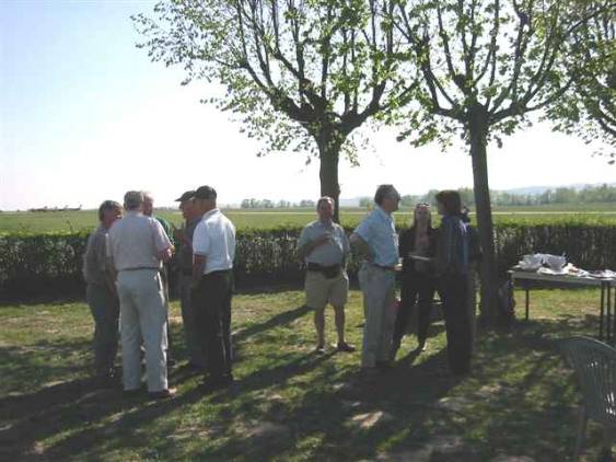
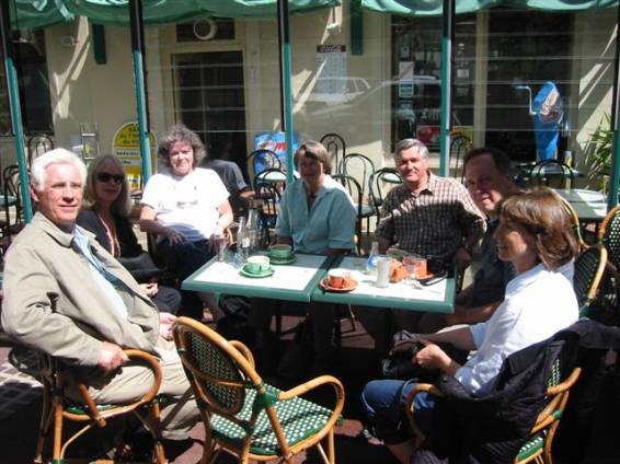
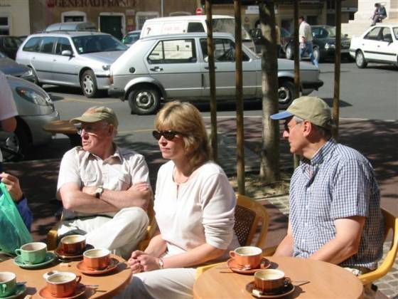
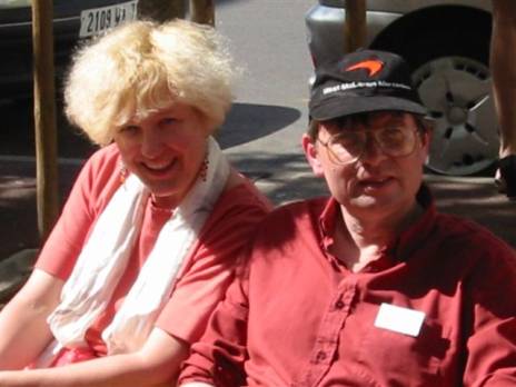
Third leg, LFKJ to Macon, France (LFLM), 360 NM as flown: We climbed to 4,500 feet and when approaching the French mainland had to climb to 8,500 in order to clear the mountains which separate the Rhone valley from the Mediterranean. Then it happened. The ground speed started to go up. We caught the tailwinds of the other low. Soon we started to see these fine ground speed numbers of 180, 190, the maximum being 205. Approaching Macon we tuned in the tower frequency: "Macon tower, this is Four X-ray Charlie Alpha Oscar, bonsoir". No answer. Again. Still no answer. Then we heard another aircraft on the frequency announcing, in French, "downwind to runway 17 at Macon". I switched to French, a language I speak fluently, and inquired about the tower. It turned out that there is a tower but it is not manned, which is a very good explanation for it being mute. We joined the club, I made the position reports in French, and we landed without any problems. Time en route 2:10, for a more respectful average of over 166 knots. Out came the cellular phones and we called the girls. They met in Geneva on the dot, made it without trouble to the hotel, and now were ready to come and pick us up. We spent the rest of the week touring Lyon and surroundings, returning to Macon on the 18th to meet the other Comancheros. The account of the fly-in is included in the Atlantic Adventurers report no.12 at www.comanchepilot.com, and here are some more photos taken by Karl during the event, while his hand was still steady.
Homeward Bound: Monday morning, the 21st; time to leave. The girls will drive to Geneva, spend the night there and catch a commercial flight next morning. Mike and I were driven to the airport and first checked the weather. A bad system with every sign in the weather books is painted on the significant weather chart, stretching all along Italy and way south of it. There is no way through for us. We decided to fly to Ajaccio, check the weather a later time and hopefully make further progress.
First leg, Macon (LFLM) to Ajaccio (LFKJ), 360 NM as flown: We filed VFR. Takeoff was to the south into a very slight headwind. We leveled at 5,500 feet and later climbed to 7,500, then 9,500, in order to clear some low lying clouds and the mountains. Otherwise, the flight was "no event" and we landed after 2:15. Average ground speed: close to 160 knots.
Second leg, LFKJ to Palermo, Sicily, Italy (LICJ), 313 NM as flown: The weather information in Ajaccio is available from a self service computerized station and there is a direct line to a meteorological office. After looking very closely at the weather charts, METARs and TAFORS, and spending time on the phone with the weather specialist we decided to proceed to Palermo, Sicily. It is not directly on the route but it was as far as we could go without challenging the weather. While there we topped the tanks, a move which will prove to be very smart. We filed VFR. Takeoff was to the south, into a light headwind. We climbed to 5,500 feet and, except for few maneuvers near and over Sardinia because of clouds, the flight was quite uneventful. We landed after 2:05, average ground speed close to 161 knots. From prior flights we remembered Palermo as a nice place to land. No more. Now Palermo is on my list of no-nos (at present, three airports strong). The adventures in Palermo merit a special article, not to mention that Avgas is no longer available 24 hours and only on a very restricted schedule. Luckily enough we had a good supply of fuel carried from France. We took a short taxi ride to the hotel near the airport we always used on such stops. The usual dinner I take there is pasta and pesce espada (which means swordfish, a Sicilian specialty) and is very good. This time, conforming to the general picture, the food was lousy. I always thought that an Italian cook who prepares such a bad pasta is executed without further questions. Apparently I was wrong.
Third leg, LICJ to Kerkira, Greece (LGKR), 335 NM as flown: Tuesday morning, the 22nd, saw us rushing early to the airport. The bad weather over Italy moved north, and we might have a chance to pass south of it. However, we should stay low and out of clouds because the conditions were on the icing side. We filed VFR (IFR would mean going up into clouds and icing), took off and climbed to 5,500 feet. After crossing the toes of Italy we started to go down because of clouds. Kerkira wanted us at 2,000 feet, so it fit us well. We landed at Kerkira after 2:05, average ground speed close to 161 knots.
Fourth leg, LGKR to Ben Gurion International Airport, Tel-Aviv, Israel (LLBG), 898 NM as flown. The weather was all over Greece but our route would be around the edges, out of the severe areas with thunderstorms, etc. There were still many cloud layers but no turbulence reports. The problem is to overfly the Peloponnesus in bad weather as the terrain is high so we would have to fly at below freezing temperatures. However, the weather picture was such that we could expect to stay between layers. On the positive side, we could expect strong tailwinds along most of the route. In view of the weather we filed IFR at 11,000 and, to our utmost surprise, the Eurocontrol computer (nicknamed the Brussels Monster) did not reject it. The destination was LLBG rather than my home base, LLSD which, because of the holidays, would be closed for international arrivals at the time of our ETA. We took off to the south and climbed en route to 11,000. The temperature there was minus 2 C, as expected, but we were indeed between the layers, so no icing. It did not take long before the ground speed started to go up and up, reaching over 200 knots from time to time. There, I noticed that the altitude hold of my faithful Altimatic II was not performing well. Soon enough I found that the pitch gimbal of the attitude indicator was failing. I disconnected the altitude hold and manually took care of the altitude all the rest of the way. Approaching the eastern coast of the Peloponnesus the clouds from below started to rise, and soon we were in cloud. Sure enough, a thin white line appeared on the outside air thermometer probe and we knew we were going to collect ice. The line became thicker, ice started to show on the wing leading edges, and when the indicated airspeed started to drop, it was nose down to descend. Past the coast we were over water all the way to destination save for a few islands with relatively low mountains. We asked for 9,000 feet, got it, and went down to temperatures above freezing levels. In no time the ice was gone and the indicated speed was restored. The rest of the flight was on the ordinary side. About 100 miles from destination the wind started to die but soon we were in a shallow descent, cruise power, and indicated air speed at the end of the green line, so we were doing fine. We ended the flight with an ILS approach to runway 12 at LLBG, with a 7 knot tailwind, and landed after 5 hours flat. Average ground speed was 179.6 knots. This is my record for this route. I had never flown it in less than 5:20.
Fifth leg, LLBG to home base (LLSD), 18 NM as flown: After clearing police and customs at Ben Gurion International Airport, our final leg still awaited. Almost as an anticlimax, we completed a short 10 minute hop into my home base which is just 9 miles away on the great circle, but the procedures are such that the distance is probably double. In total we flew, sans the above mentioned short hop, a distance of 3,821 NM which we covered in 23:45 hours, for an overall average speed of 160.9 knots.
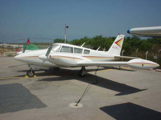
Omri Talmon, born in 1936, lives in Tel Aviv, Israel. He holds degrees in engineering, business administration and accounting. Presently a consultant, he worked for many years as an executive for several hi-tech companies. Omri is a private pilot with both Israeli and U.S. certificates. His ratings include SEL, MEL, Instrument, Glider, and CFI (glider). Since 1974 he owns and flies a 1966 PA-30-B, registration 4X-CAO.
|
||||||||
|
|
||||||||